SnowCast
SnowCast is an experimental Canadian Hydrological Model (CHM) data product that downscales the Global Environmental Multiscale (GEM) model forecasts from Environment and Climate Change Canada (ECCC) to provide high resolution snowpack forecasts that take into account variable windflow, solar radiation, precipitation, and temperature over complex terrain.
Downscaling is accomplished through a coupled snow redistribution and ablation model that is run at high resolution. Redistribution is calculated by gravity and wind transport and forest canopy interception. Ablation is calculated by snow sublimation and melt of forest canopy and surface snowpacks.
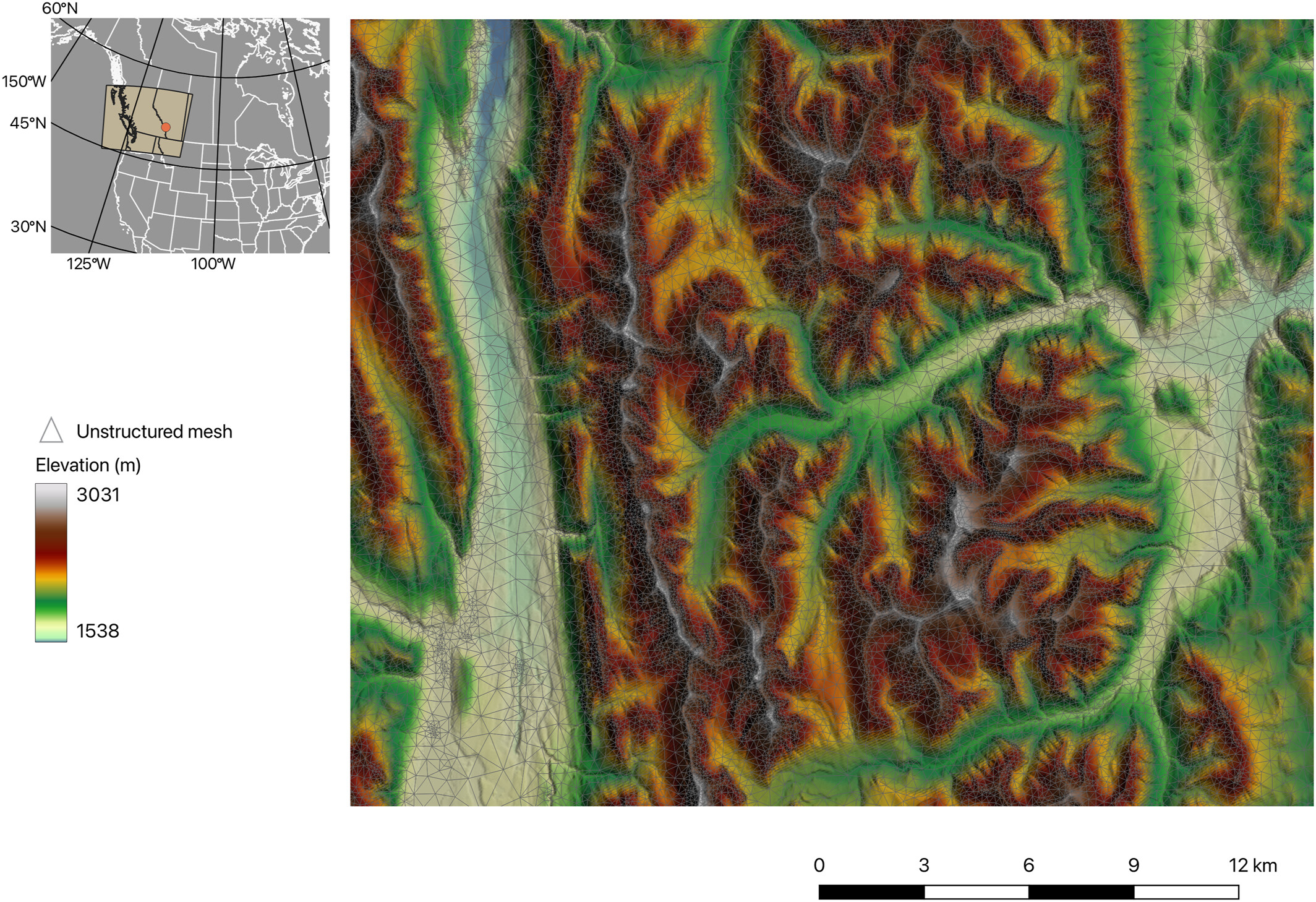
The model domain is centred over Banff National Park, Canada and extends over a region from the US border north to Mount Robson Provincial Park, and from east of Strathmore, Alberta west to Mara Lake, British Columbia.
SnowCast is developed under an on-going collaboration between researchers at Environment and Climate Change Canada (ECCC) and the University of Saskatchewan. Key advances were supported via the Global Water Futures Next Generation modelling theme in the Core Modelling Team and the Centre for Hydrology. SnowCast is developed and maintained by Dr. Christopher Marsh at the University of Saskatchewan (adjunct) and in collaboration with Dr. Vincent Vionnet and Dr. Christopher Marsh from ECCC, and Dr. John Pomeroy at the University of Saskatchewan. The original SnowCast concept was developed by Dr. Nic Wayand.
Despite this collaboration, no guarantees or warranties are made about reliability of output, availability, or access to data. This is not an operational product. Use is entirely at the user's own risk.
Two GEM forecasts are currently used:
- GEM 2.5 km 2-day forecasts (High Resolution Deterministic Prediction System (HRDPS))
- [Under development] GEM 25 km 6-day forecasts (Global Deterministic Forecast System (GDPS)
DISCLAIMER: DO NOT USE FOR DECISION MAKING, EXPERIMENTAL!
2-day forecast
Model Outputs
Two model outputs, SWE and snow depth, are provided for a) the start of the model run (current) and b) for a period in the future (forecast).
Model outputs are regridded to a 0.001° x 0.001° (~70 m x ~70 m) spatial resolution.
Variables
SWE -- Snow Water Equivalent is the amount of water stored in the snowpack, given as an equivalent depth of water (mm) which is the same as mass per unit area (kg/m2).
Snow Depth -- Snow depth is the depth of snow in metres.
View GeoTiffsCanadian Hydrological Model (CHM)
The Canadian Hydrological Model (CHM) is a modular, multi-physics, spatially distributed modelling framework designed for representing cold-regions hydrological processes. CHM uses existing high-quality open-source libraries and modern high-performance computing practices to provide a framework that allows for integration of a wide range of process representations, ranging from simple empirical relationships to physics-based, state-of-the-art algorithms. Modularity in structure and process representation allows for diagnosis of deficiencies in these aspects of the model. CHM also has sufficient flexibility in spatial representation and algorithm parameterisation to assess uncertainty in model structure, parameters, initial conditions, process representation, and spatial and temporal scales. By utilizing unstructured meshes, fewer than 1% of the computational elements of high-resolution structured (raster) grids are usually necessary. This preserves surface and sub-surface heterogeneity but results in fewer parameters and initial conditions.
Snowcast current reprsents snowprocess (avalanching, blowing snow, energy balance snowmodel) and canopy interactions. The snowpack model is FSM 2.0 (Essery et al, 2015) and the windfields are downscaled with Windmapper (Marsh et al, 2023). The other physical processes are as described in the CHM paper (Marsh et al, 2020).
Snowcast runs the model configuration described in Marsh, et al. 2024.
- Hourly timestep
- ~100 m resolution
- Energy balance 6-layer snowmodel
- Energy balance canopy interception
- Blowing snow and avalanching
Select publications:
Marsh, C. B. et al. Snowdrift‐Permitting Simulations of Seasonal Snowpack Processes Over Large Mountain Extents Water Resour. Res., 60, 2024. [ DOI ]
Marsh, C. B., Vionnet, V. & Pomeroy, J. W. Windmapper: An Efficient Wind Downscaling Method for Hydrological Models Water Resour. Res., 59, 2023. [ DOI ]
Marsh, C.B., J.W. Pomeroy, and H.S. Wheater. The Canadian Hydrological Model (CHM) v1.0: a multi-scale, multi-extent, variable-complexity hydrological model – design and overview. Geoscientific Model Development, 13(1):225--247, 2020. [ DOI ]
Marsh, C.B, J.W. Pomeroy, R.J. Spiteri, and H.S Wheater. A Finite Volume Blowing Snow Model for Use With Variable Resolution Meshes. Water Resources Research, 56(2), 2020. [ DOI ]
Vionnet V., Marsh, C.B., B. Menounos, S. Gascoin, N.E. Wayand, J. Shea, K. Mukherjee, and J.W. Pomeroy. Multi-scale snowdrift-permitting modelling of mountain snowpack. The Cryosphere, 15:743–--769, 2021. [ DOI ]
Marsh, C.B, R.J. Spiteri, J.W. Pomeroy, and H.S. Wheater. Multi-objective unstructured triangular mesh generation for use in hydrological and land surface models. Computers & Geosciences, 119:49--67, 2018. [ DOI ]